
SORKHEH HESAR Pedestrian Bridges
Project Type: Pedestrian and Bicycle Bridge- View Point- Urban Space ; Design: Karand Architectural Group ; Client: Tehran Municipality
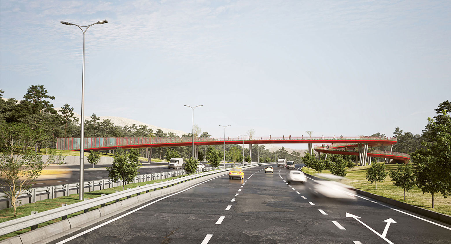
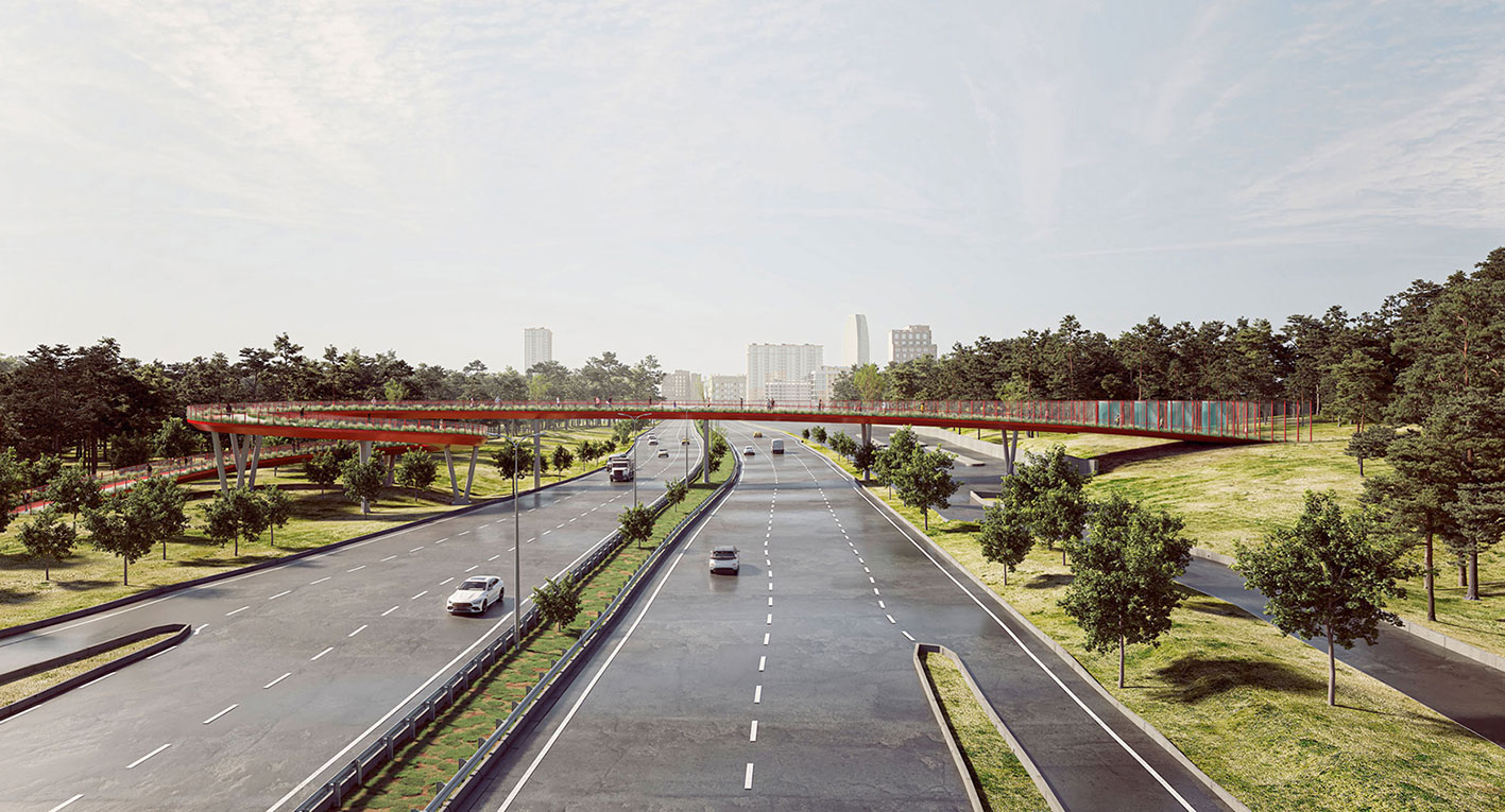
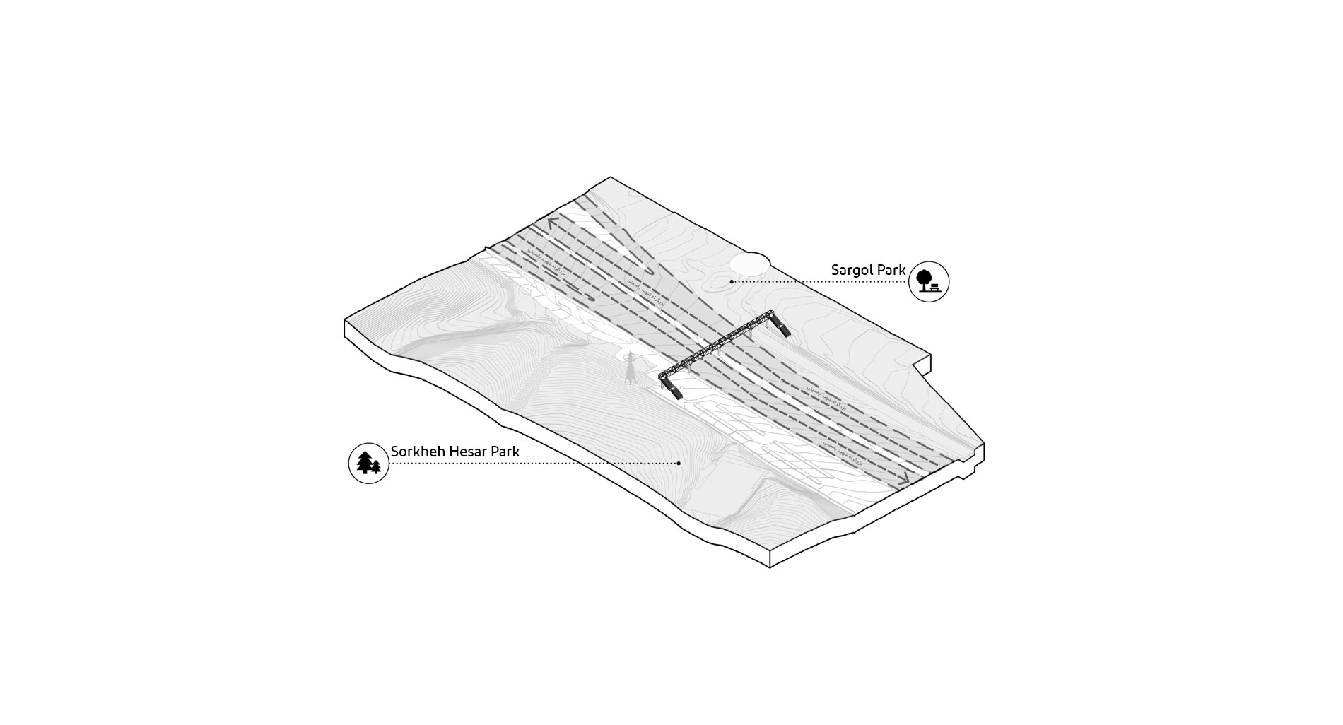
Commissioned by Tehran municipality, Karand architectural group developed design ideas for two pedestrian and cycle bridges in district 13 of Tehran. Spanning over Shahid Yasini highway, these bridges connect Sorkheh Hesar National Park in the south to the neighborhoods in the north, facilitating better pedestrian and bicycle connections in this part of the city.
According to the Yasini pedestrian bridges feasibility plan that aimed to enhance tourist attractions in this area, five places were chosen for constructing new pedestrian bridges. This project aimed to design bridges number 2 and 5.
Bridge number 2
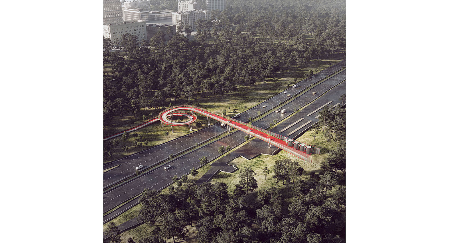
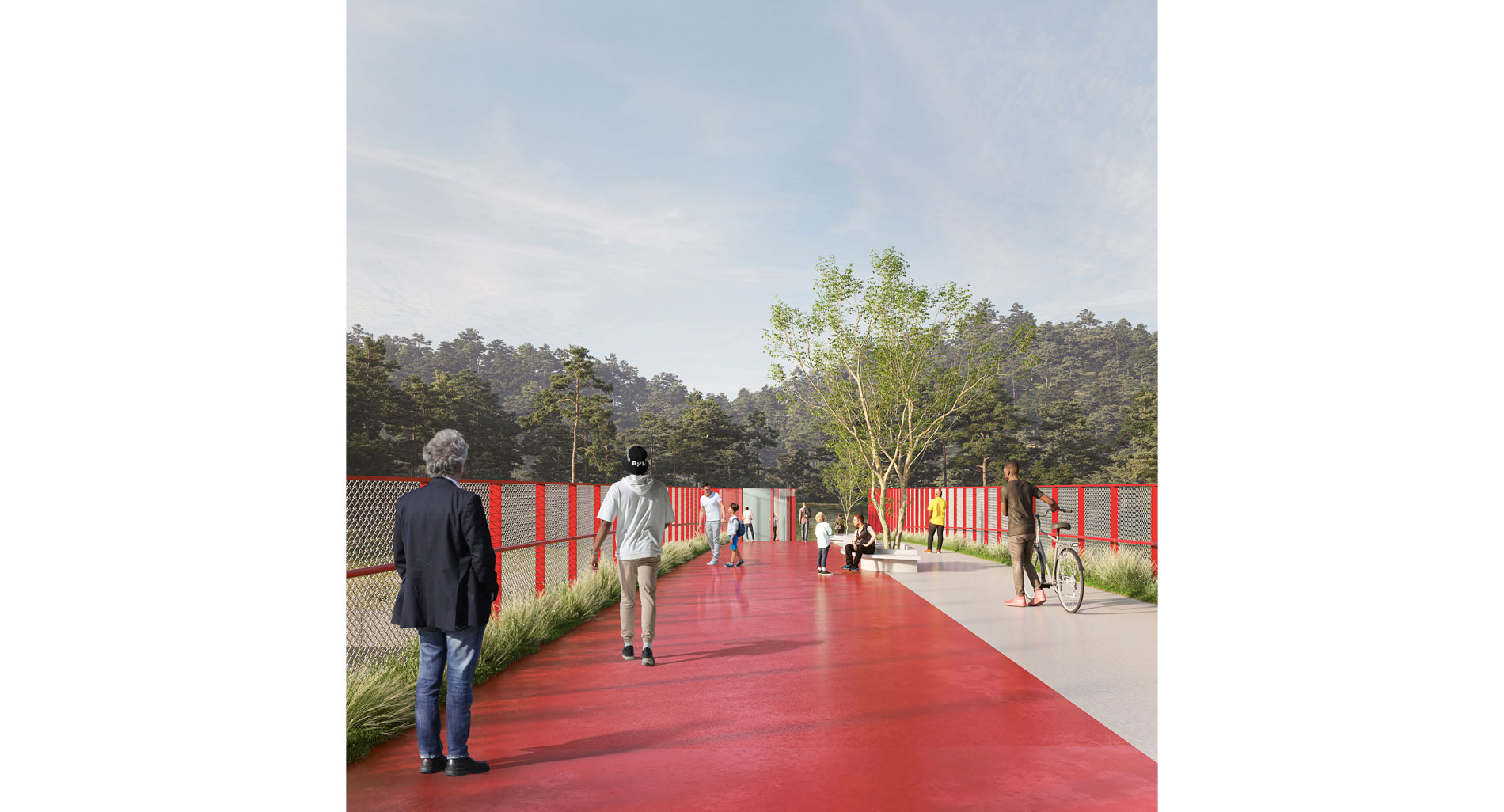
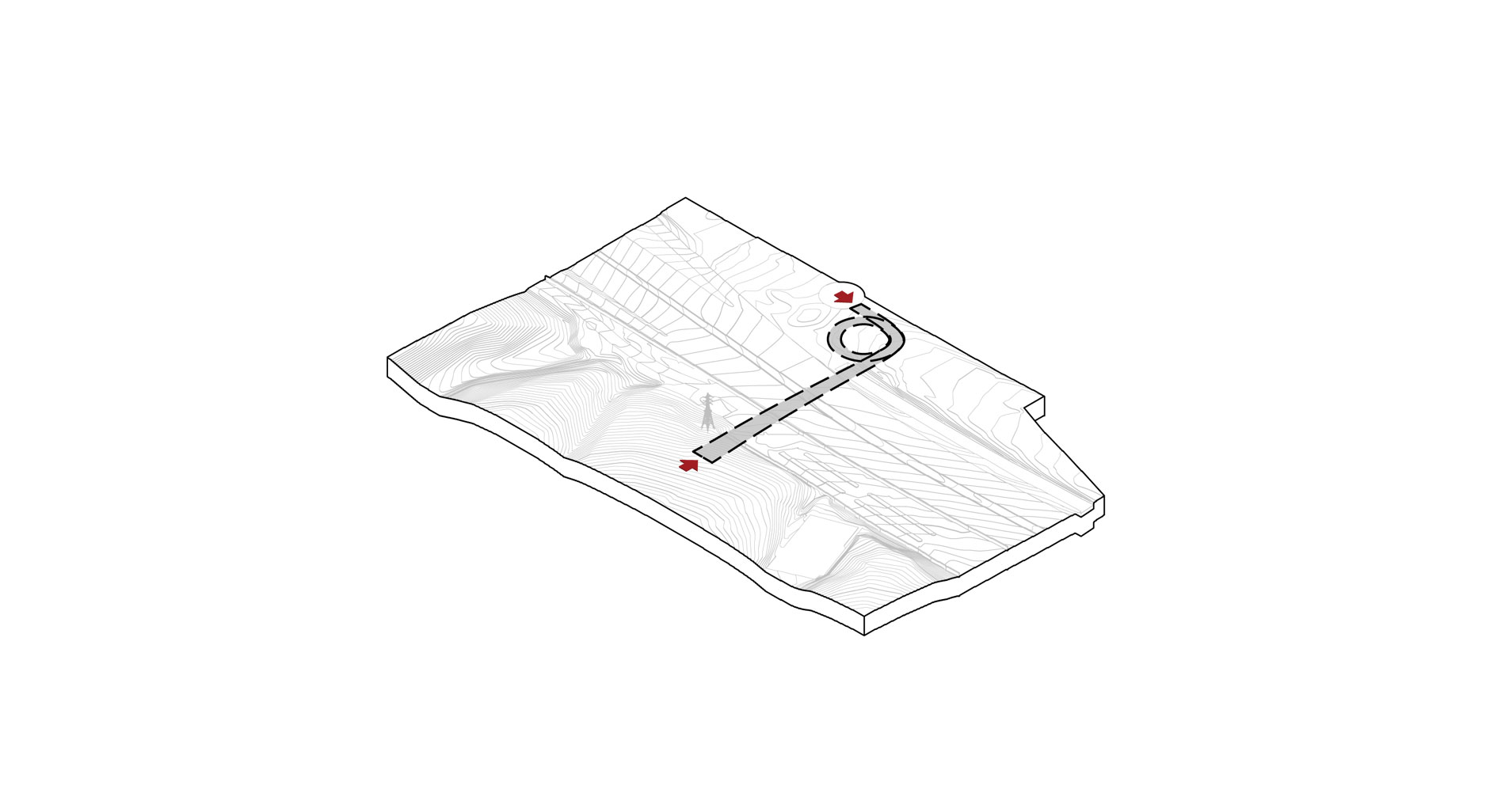
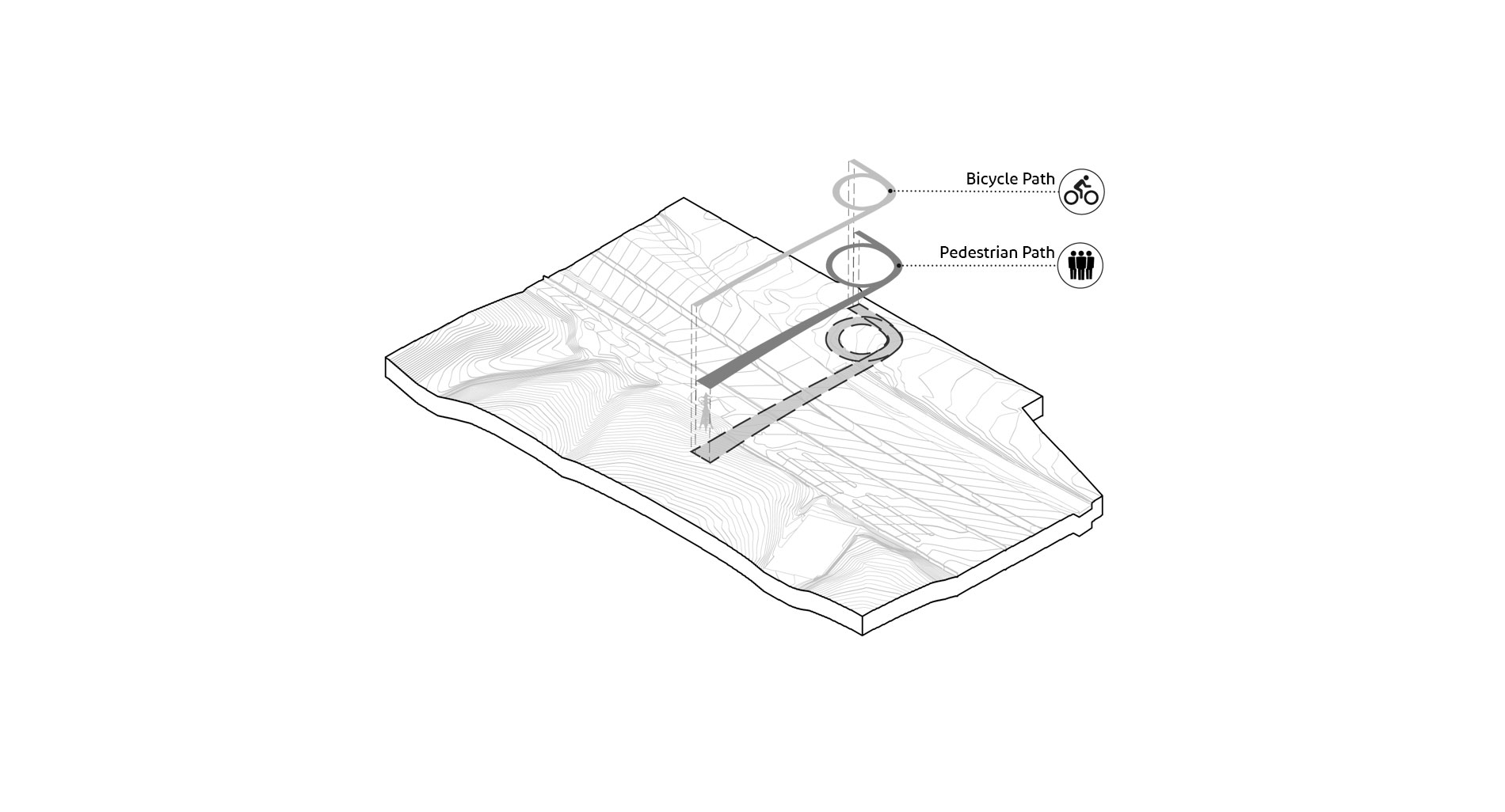
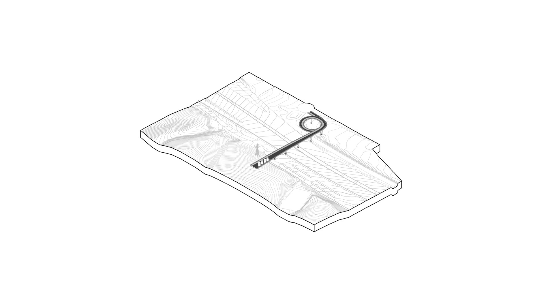
Currently, there is a pedestrian bridge in the location of bridge 2, which needs to be renovated. In the new plan for this bridge, a 2.5-meter-wide bike path is added to the pedestrian path, and the width of the pedestrian path increases gradually, from 2.5-meter in the north to 8.5-meter in the south. These paths are continuous ramps, appropriate for pedestrians and bicycle movement from every walk of life. Starting from Sorkheh Hesar National Park in the south, the spiral ramp connects the bridge surface to the ground level at Sargol Park. The space will be inclusive and accessible for all users.
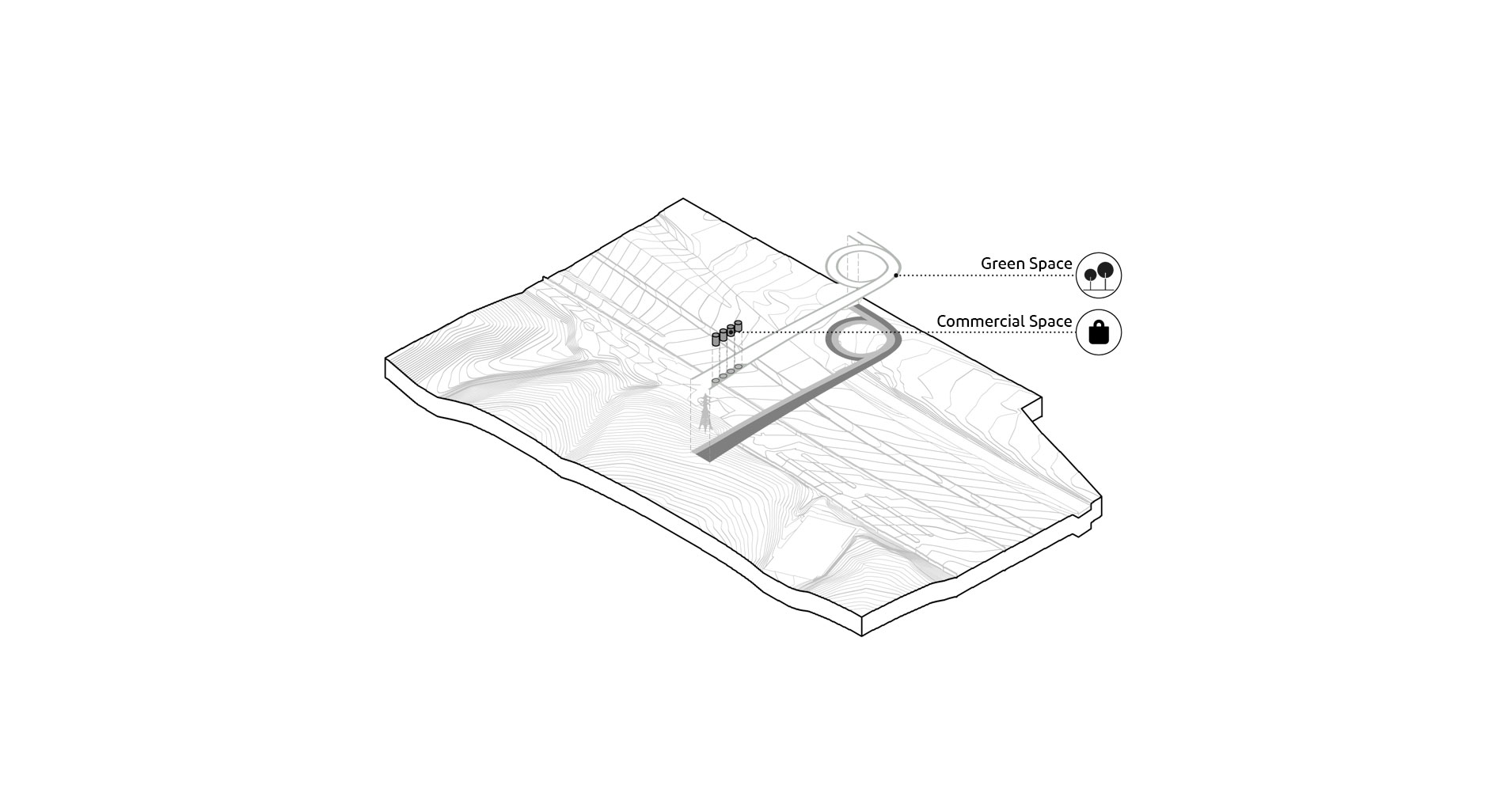
There are two lanes of 0.5-meter-wide green space on the bridge’s edges, which have been widened at the eastern edge of the bridge near Sorkheh Hesar National Park.
Finally, the commercial spaces in the form of four cylindrical booths, with a radius of 1.5 meters, an area of 7 m2 and a variable height between 3.30 and 4.40 meters were added to the southern part of the bridge space.
This bridge allows pedestrians to pause and appreciate the parks’ landscape as well as the panoramic view of the city. Besides, it will have a vibrant mix of pedestrian and cycle paths, and green and commercial spaces, connected by Sargol Park in the north and Sorkheh Hesar National Park in the south.
Bridge number 5
There are three different pedestrian bridges in this part of the area, located on Damavand Street, Shahid Yasini highway, and the exit of Shahid Yasini highway towards Zeyn-Od-Din Highway. These three existing bridges connect the residential area in the north to Sorkheh Hesar National Park in the south but they are low quality in design.
Bridge number 5 will be a continuous 138-meter-long bridge that will be replaced by the previous bridges, sitting harmoniously within the natural environment. The bridge has a viewpoint in the middle, allowing pedestrians to have a fascinating panoramic view of the area.
This curved 450-meter-long bridge will consist of two 2.5-meter-wide paths, one for pedestrians and another for cyclists. The bridge has three entrances at the beginning, end, and the middle. The pedestrian path is connected to the observation tower in the vicinity of Sorkheh Hesar park.
The 40-meter above the ground spiraling observation tower will offer 360-degree panoramic views across the park, mountains, and the city. Featuring beside the bridge, the observation tower will provide a new perspective and immersive experience from within and above the trees and city. Using a 700-meter-long ramp with a width of 3-meter, this observation tower lifts pedestrians from the bridge level.
The reconstruction of the bridge number 5 will not only facilitate the pedestrian and cyclists’ movement but also revitalize the lost spaces around the Yasini highway and Damavand Street. The bridge will be a place to both pass and stay. It will be an attractive place, and a great destination for people to walk, interact and spend their leisure time, and it will allow them to pause and appreciate the park and the northern mountains’ landscape.
The design proposal has a minimal impact on the natural elements of the parks, and the observation tower was placed based on the location of the trees in Sorkheh Hesar National Park.